Category Archives: Lightblueline

“Bring back the line,” the Poodle says. And he’s angry.

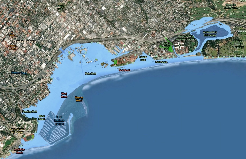
Here’s the link: Bring Back the Light Blue Line to Santa Barbara Streets

Map probably from City of Santa Barbara…

“…

For all of City Hall’s many faults, the council deserves credit for passing meaningful measures ​— ​not just purity posturing and virtue signaling ​— ​designed to address climate change. Much of it’s wonky and defies simple sound-bite summation. 

One example is its vote-prohibiting natural-gas hookups in most new developments ​— ​much to the chagrin of energy companies. Natural gas contains greenhouse-gas emissions 86 times more destructive than carbon dioxide. When the council voted, only one member of the public spoke against it. So much for climate change not being a local issue.

Then there’s the council adoption of the Clean Energy Initiative, in which our City Hall joins with other city halls up and down the coast to form partnerships to buy less polluting energy for our residents than what SoCal Edison would otherwise be selling. In this deal, Edison will be tasked with getting this energy from its source to our homes. If there’s any surplus generated by these transactions, the proceeds can be used to, among other things, help create new locally based energy supplies. The hope is that this program will cut carbon emissions from electricity consumed by city residents by 20 percent. 

That’s not a local issue?

While the rest of us were sleeping, the same City Hall that’s reviled for doing nothing quietly created a new Department of Sustainability & Resilience. Co-running this show is Alelia Parenteau, a wonderfully named badass who, as a young City Hall intern years ago, spent six months riding on the back of trash trucks to track what happens to our recycled wastes.

Not to be crassly obvious, but even the skeptics and deniers have been forced to admit that the occasional drought, wildfire, and flood have now been insanely fueled by climate change. How many of those “we-are-heroes” gummy bracelets must future debris-flow victims have to wear? 

Not a local issue? 

If not us, then who? 

Bring back the Light Blue Line.”

Comments Off on “Bring back the line,” the Poodle says. And he’s angry.

Filed under Lightblueline

Great article on the Greenland Ice Sheet

If the Greenland ice sheet melts, what happens to New York City? This reporter went to find out.  Janet Babin. PRI

“A total melting of the Greenland ice sheet would raise sea levels by roughly 25 feet. Schaefer says he’s not scared that will happen again anytime soon. Other researchers aren’t sure it will happen at all. But Schaefer says even half a foot of sea level rise from Greenland is possible by the end of the century. That, he says, would be a “disaster for society.”

But it would still be a creeping disaster, one too slow to register in most people’s daily lives — except when the coast gets hit by big storms.

After I came back from Greenland, I moved out of Brooklyn to Wall Street. Dozens of buildings in this part of town flooded. Some lost power and elevator service. And subways stations in this area of downtown were closed — in some cases, for months. The trains are up and running, but not much has changed.

A few towers have moved their electrical systems to higher floors. The city has rebuilt some parks to hold more water during storms.

And there’s talk of bigger changes. The US Army Corps of Engineers recently began holding public meetings on whether to build berms, seawalls and storm surge barriers along New York’s shoreline.  But those plans would take decades and billions of dollars to implement.

I went to Greenland to try to get a better fix on how the future of the ice sheet could affect my city. But what I learned is that while details will continue to evolve, we know enough already that we should be doing a lot more to protect coastal cities from climate change and sea level rise.

If I thought the trip would allay my fears, I was wrong. Seeing the ice up close made me realize the vastness of the world’s loss.

Like my neighbors, I’m nervous about the next storm — how the flooding could keep getting worse while our government focuses on the smaller picture. I contemplate where I could move, but east coast options are limited. In New York City, just about every neighborhood could be impacted.”

Here is the link:

https://www.pri.org/stories/2018-09-28/if-greenland-ice-sheet-melts-what-happens-new-york-city-reporter-went-find-out?fbclid=IwAR2XBWAClHuwUyZtAKPioNej4AKFV4T843CgvnaHB7hPYnyH2z-1YAHoISw

Comments Off on Great article on the Greenland Ice Sheet

Filed under Lightblueline

New 10 foot sea level rise map from Climate Central

Just noticed that this 10-foot rise map of Santa Barbara looks a lot like the 7 meter map we made for Lightblueline.  It turns out that we took the mean tide line, while the best practice is to take the lesser-highest annual tide as the basis for the map. Take a look…

NOTE for our real-estate sales friends, this map’s data is all about lost property value :-).

 
http://ss2.climatecentral.org/widget.html?utm_source=Lightblueline&utm_medium=embed&utm_campaign=SS2-Map#14/34.4161/-119.6902?show=property&level=10&pois=hide&contentTitle=Ten%20feet%20(including%20high%20tide)

NOTE for everyone: James Hansen and others have published a paper (in the process of being openly peer-reviewed) that argues the possibility of a 10-foot rise by 2050.

Comments Off on New 10 foot sea level rise map from Climate Central

Filed under Lightblueline

Salon article about a Twitter campaign: #drownyourtown

At 3 meters, the airport is under water.

At 3 meters, the airport is under water.

Lindsay Abrams at Salon writes:

“Sea levels are rising – what will that mean for your city? Andrew David Thaler, a marine biologist who blogs at Southern Fried Science, has taken to Twitter to find out. The result, #DrownYourTown, has become the official hashtag of the apocalypse.

Thaler’s original concept was to show cities at 80 meters, or about 262 feet, of sea level rise: the extreme end of climate change predictions. He created his renderings using GIS modeling overlaying Google Earth images with a simulation of the rising tides. In the manipulated images, Miami is gone while only the top of the Washington Memorial pokes through in downtown D.C. The project served as both a dire warning and a promotional device for his self-described “dystopian maritime science fiction serial adventure” book series.

Yesterday, Thaler started fielding requests from Twitter to drown users’ hometowns, and he’s back at it again today. The results are more far-fetched for some cities — like Denver, which is sitting pretty at 1.612 meters above sea level — than others. The prognosis for Jacksonville, as he puts it, is “less ‘neat’ and more ‘oh crap that’s bad news.’” None of the renderings are overly realistic-looking, either — this isn’t “Day After Tomorrow”-level technology. But the pang of recognition imparted from seeing a familiar landscape under a sudden layer of blue certainly makes climate change feel a bit more real.”


Comments Off on Salon article about a Twitter campaign: #drownyourtown

Filed under Lightblueline

Bruce Caron UCSB Sea Level Talk, February 1, 2013

Bruce gave this talk at UC Santa Barbara for a conference called Interactive Visioning. It didn’t make the UCTV edition, so here it is on YouTube:


Comments Off on Bruce Caron UCSB Sea Level Talk, February 1, 2013

Filed under Lightblueline

Lightblueline on local TV in 2007

In 2007, the Lightblueline project was working through the city process to be a public art project. The local public access TV station did a short piece on the topic of climate change.

Comments Off on Lightblueline on local TV in 2007

Filed under Lightblueline

Visualizing sea level rise: Mashable article

DC under 7+ meters of water

I’m looking forward to the final event in the Figuring Sea Level Rise, next Friday at UCSB.

Here’s an artist who knows some great Photoshop tricks to visualize cities impacted by rising sea levels.

Rising Seas Swallow 8 Cities in These Climate Change GIFs

On Mashable, Lorenzo Franceschi-Bicchierai writes:

“Climate change and global warming may cause sea levels to rise and flood coastal cities across the world. Over the past century, the Global Mean Sea Level has risen by 4 to 8 inches. And according to estimates by the National Oceanic and Atmospheric Administration (PDF), it will keep rising between 8 inches and 6.6 feet by 2100.

How will the world look if that happens? In November of 2012, The New York Times published interactive maps displaying the effects of the sea level rising, in a series titled “What Could Disappear?” The maps show how much land the sea will claim in the future, if it rises by 5, 12, and 25 feet.

Nickolay Lamm, a 24-year-old researcher and artist saw the interactive maps and wondered: “What would this actually look like in real life?” Lamm told Mashable in an email interview that “the only imagery I had of sea level rise came from Hollywood.” So he decided to put his skills to work.

“I felt that if I could bring these maps to life, it would force people to look at sea level rise in a new way,” he said.

UPDATE: Nicolay has now done a series on the US West Coast Cities

Comments Off on Visualizing sea level rise: Mashable article

Filed under Lightblueline

Lightblueline photos on Flickr


Here is the archive of photos from the original Santa Barbara lightblueline project on Flickr.

Comments Off on Lightblueline photos on Flickr

Filed under Lightblueline

Google Earth layers for Santa Barbara sea level rise

At 3 meters, the airport is under water.

Here are the 1 meter, 3 meter, 5 meter, and 7 meter sea-level rise data display layers (KMZ) for Santa Barbara and Goleta.

To use: open these in Google Earth.

Created by Darren Hardy and Frew.

Comments Off on Google Earth layers for Santa Barbara sea level rise

Filed under Lightblueline, Projects

Goleta seven-meter sea-level rise map (pdf)

This map was made by Darren Hardy (UCSB) with a DEM and ESRI software.

PDF file: 2007-02-27 7m Goleta

Goleta 7 meter sea-level rise map

Comments Off on Goleta seven-meter sea-level rise map (pdf)

Filed under Lightblueline